
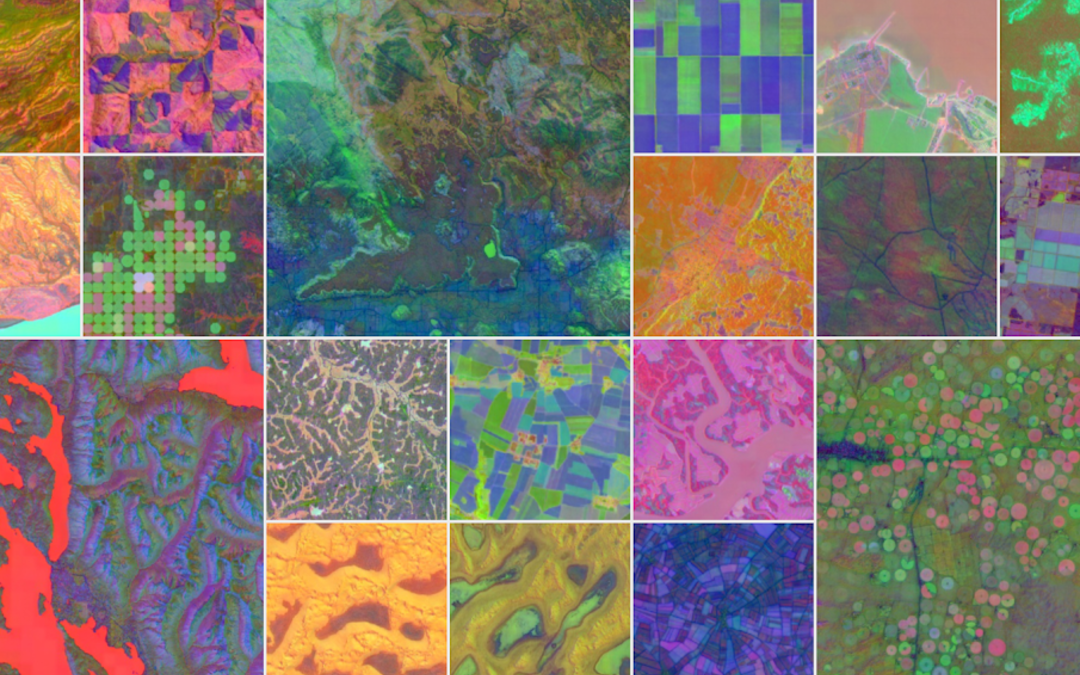
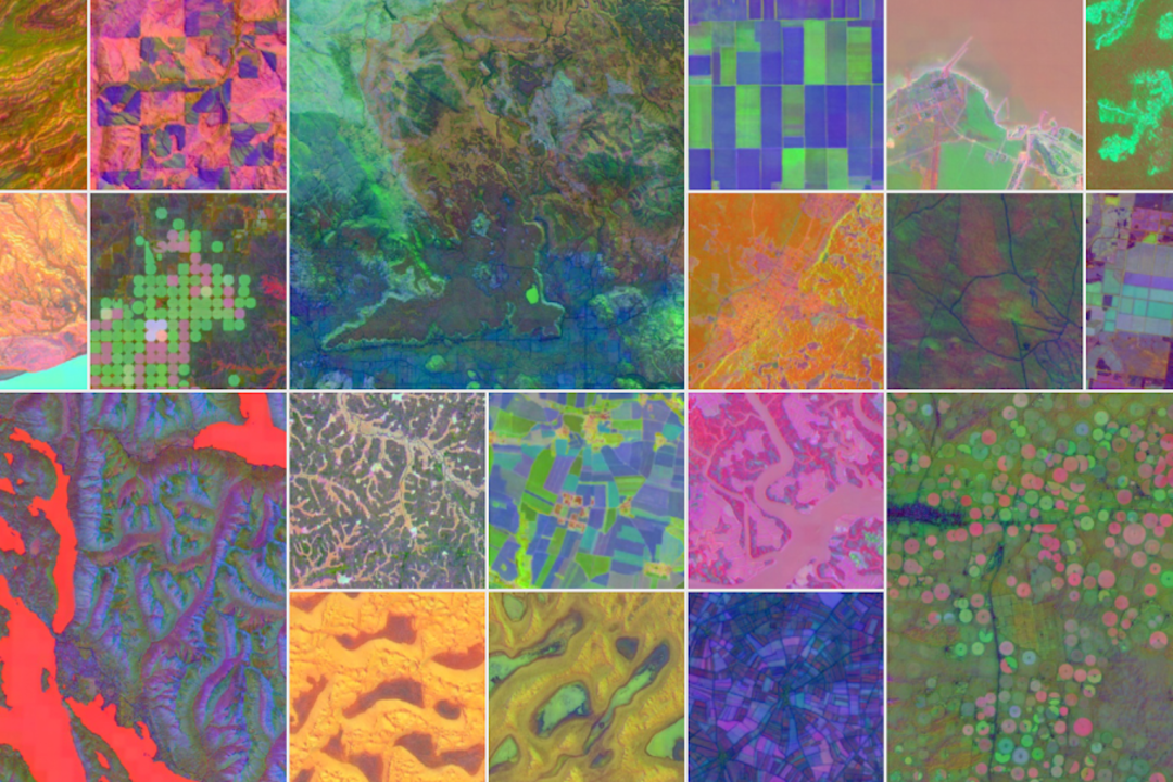
Google on Wednesday launched AlphaEarth Foundations, an artificial intelligence model that integrates vast quantities of satellite and environmental data to produce the most detailed and consistent maps of the planet to date.
The model, developed by Google DeepMind and Google Earth Engine, fuses petabytes of Earth observation data — ranging from optical imagery to radar and climate simulations — into a single digital format that can be used to track changes in terrestrial land and coastal waters with high precision.
AlphaEarth Foundations is being hailed by researchers as a “virtual satellite” that can see through cloud cover, span multiple data types, and cut the storage cost of global mapping efforts by a factor of 16.
A New Kind of Foundation
“This breakthrough enables scientists to do something that was impossible until now: create detailed, consistent maps of our world, on demand,” Google said in a statement.
The model works by generating what researchers call an “embedding” — a compact summary of a 10 x 10 meter patch of the Earth.
These summaries make it easier for scientists and policymakers to analyse long-term environmental and agricultural changes, deforestation, and urban sprawl using consistent data from diverse sources.
Unlike traditional remote sensing methods, AlphaEarth Foundations achieved a 24 percent lower error rate on average than existing AI systems during field tests, even when labeled data was scarce, according to Google.
Dataset Powering Global Research
The company has also released a Satellite Embedding dataset derived from AlphaEarth Foundations in Google Earth Engine.
It includes more than 1.4 trillion embedding footprints annually and is already being used by over 50 organizations, including the United Nations’ Food and Agriculture Organization, Stanford University, and the Group on Earth Observations.
Brazilian nonprofit MapBiomas is using the dataset to map environmental and agricultural trends across sensitive ecosystems such as the Amazon.
“The Satellite Embedding dataset can transform the way our team works—we now have new options to make maps that are more accurate, precise and fast to produce,” said Tasso Azevedo, founder of MapBiomas.
In Ecuador, AlphaEarth Foundations has been able to map agricultural plots through persistent cloud cover.
In Antarctica, the model has captured detailed terrain in areas traditionally obscured due to irregular satellite coverage. In Canada, it has detected subtle land use patterns invisible to the human eye.
Supporting Global Conservation
The Global Ecosystems Atlas initiative is using the dataset to help governments identify and classify unmapped ecosystems such as coastal shrublands and hyper-arid deserts — critical steps in prioritizing conservation and restoration.
“The Satellite Embedding dataset is revolutionizing our work,” said Nick Murray, Director of the James Cook University Global Ecology Lab and Global Science Lead of the initiative. “It’s helping countries map uncharted ecosystems—crucial for pinpointing where to focus their conservation efforts.”
Future Directions
Google said it is exploring further applications for AlphaEarth Foundations, including combining its time-series capabilities with general-purpose language models such as Gemini to enable more sophisticated Earth monitoring and planning tools.
The release is part of Google Earth AI, the tech giant’s broader initiative to provide geospatial data and tools for addressing global environmental challenges.